Pine Ridge, Oklahoma: Difference between revisions
imported>James Branum (New page: 250px|thumb|Pine Ridge. 250px|thumb|The [[Pleasant View Cemetery at Pine Ridge has graves from many of the early pioneers of the community...) |
mNo edit summary |
||
| (4 intermediate revisions by 3 users not shown) | |||
| Line 1: | Line 1: | ||
[[Image: | {{subpages}} | ||
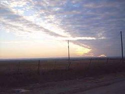
[[Image: | [[Image:pineridge1.jpg|250px|thumb|Pine Ridge.]] | ||
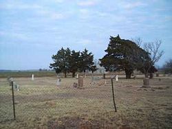
[[Image:pineridge2.jpg|250px|thumb|The [[Pleasant View Cemetery]] at Pine Ridge has graves from many of the early pioneers of the community.<ref>[ftp://ftp.rootsweb.com/pub/usgenweb/ok/caddo/cemeteries/plsntvew.txt Pleasant View Cemetery, Caddo County OK]</ref>]] | |||
'''Pine Ridge''' is an [[unincorporated area|unincorporated community]] in [[Caddo County, Oklahoma|Caddo County]], [[Oklahoma]], [[United States]], located 6 miles south and 1/2 mile west of [[Fort Cobb, Oklahoma|Fort Cobb]]. During the community's heyday in the 1940s there was a hub of activity at the main junction of the Ozark Trail and the Fort Cobb road with a Grocery Store, and two churches ([[Hopewell Missionary Baptist Church]], and [[Pine Ridge Church of Christ]] (which later merged into the [[Fort Cobb Church of Christ]], but today only the [[Baptist]] Church building remains (which is now used as a barn). | '''Pine Ridge''' is an [[unincorporated area|unincorporated community]] in [[Caddo County, Oklahoma|Caddo County]], [[Oklahoma (U.S. state)|Oklahoma]], [[United States of America]], located 6 miles south and 1/2 mile west of [[Fort Cobb, Oklahoma|Fort Cobb]]. During the community's heyday in the 1940s there was a hub of activity at the main junction of the Ozark Trail and the Fort Cobb road with a Grocery Store, and two churches ([[Hopewell Missionary Baptist Church]], and [[Pine Ridge Church of Christ]] (which later merged into the [[Fort Cobb Church of Christ]], but today only the [[Baptist]] Church building remains (which is now used as a barn). | ||
According to locals, the community got its name from the community of [[Pine Ridge, Arkansas]] that was the setting of the radio show [[Lum and Abner]] which aired from 1934-1952. Legend says that the owner of the grocery store named it "Pine Ridge" after the radio show and over time the name was adopted as the name of the whole community. | According to locals, the community got its name from the community of [[Pine Ridge, Arkansas]] that was the setting of the radio show [[Lum and Abner]] which aired from 1934-1952. Legend says that the owner of the grocery store named it "Pine Ridge" after the radio show and over time the name was adopted as the name of the whole community. | ||
| Line 27: | Line 28: | ||
[[Category:Unincorporated communities in Oklahoma]] | [[Category:Unincorporated communities in Oklahoma]] | ||
{{Oklahoma-geo-stub}} | {{Oklahoma-geo-stub}}[[Category:Suggestion Bot Tag]] | ||
Latest revision as of 11:00, 4 October 2024

Pine Ridge is an unincorporated community in Caddo County, Oklahoma, United States of America, located 6 miles south and 1/2 mile west of Fort Cobb. During the community's heyday in the 1940s there was a hub of activity at the main junction of the Ozark Trail and the Fort Cobb road with a Grocery Store, and two churches (Hopewell Missionary Baptist Church, and Pine Ridge Church of Christ (which later merged into the Fort Cobb Church of Christ, but today only the Baptist Church building remains (which is now used as a barn).
According to locals, the community got its name from the community of Pine Ridge, Arkansas that was the setting of the radio show Lum and Abner which aired from 1934-1952. Legend says that the owner of the grocery store named it "Pine Ridge" after the radio show and over time the name was adopted as the name of the whole community.
Pine Ridge is located at the junction of the blacktop road going directly south from Fort Cobb and the old Ozark Trail (an early predecessor to Route 66).
The Pine Ridge Community mostly consists of wheat and hay farming and cattle ranching. There is also a winery east of Pine Ridge on the Ozark Trail (Woods and Waters Winery and Vineyard). Greenfield Mennonite Church[2] is also still active in the community and is located 6 miles west and 2 miles south of the Pine Ridge corner. There is a small cemetery on the church grounds as well.[3]
Public school students in Pine Ridge attended school at Broxton until the school district was consolidated with Fort Cobb in the 1990s. Telephone numbers for the Pine Ridge area are split between the Fort Cobb and Apache prefixes.
Pine Ridge is in State House District 56 [4] and in State Senate District 26.[5]
