File:Narciso Durán’s Map of Mission San José 1824.jpg: Difference between revisions
Jump to navigation
Jump to search
imported>Robert A. Estremo ({{Image_Details|pd |description = A topographical map of Mission San José’s territory shows San Francisco Bay at the lower left and the complex of rivers in the San Joaquin Valley, beyond the Coast Range, at the upper right. Christianized Native vi...) |
(== Summary == Importing file) Tag: Server-side upload |
||
| Line 1: | Line 1: | ||
== Summary == | == Summary == | ||
Importing file | |||
Latest revision as of 19:58, 11 March 2022
Summary
Importing file
File history
Click on a date/time to view the file as it appeared at that time.
| Date/Time | Thumbnail | Dimensions | User | Comment | |
|---|---|---|---|---|---|
| current | 19:58, 11 March 2022 | 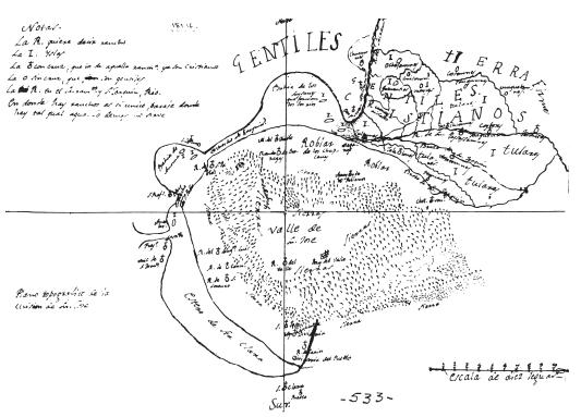 | 533 × 383 (43 KB) | Maintenance script (talk | contribs) | == Summary == Importing file |
You cannot overwrite this file.
File usage
The following page uses this file: