File:Vancouver-island-lambert-azimuthal.png
Jump to navigation
Jump to search
Vancouver-island-lambert-azimuthal.png (514 × 411 pixels, file size: 13 KB, MIME type: image/png)
Summary
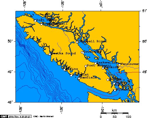
The longitude and latitude of the Cities, as used to create this map, follow:
- -127.4193,50.6949,Port Hardy
- -123.3655,48.4286,Victoria
- -124.8055,49.2339,Port Alberni
- -123.9378,49.1638,Nanaimo
- -123.7079,48.7787,Duncan
- -125.8813,49.1140,Tofino
- -125.5339,48.9273,Ucluelet
- -126.6265,49.6170,Nootka Sound
- -123.1136,49.2618,Vancouver
- -127.0848,50.5901,Port McNeill
- -125.2454,50.0231,Campbell River
- -124.3150,49.3187,Parksville
- -124.9927,49.6869,Courtenay
- -124.9283,49.6729,Comox
- -125.1426,48.8334,Bamfield
- -123.3986,48.6506,Sidney
Summary
Licensing/Copyright status
File history
Click on a date/time to view the file as it appeared at that time.
| Date/Time | Thumbnail | Dimensions | User | Comment | |
|---|---|---|---|---|---|
| current | 18:52, 11 March 2022 |  | 514 × 411 (13 KB) | Maintenance script (talk | contribs) | == Summary == Importing file |
You cannot overwrite this file.
File usage
The following 2 files are duplicates of this file (more details):
- File:Vancouver-island-lambert-azimuthal.png from a shared repository
- File:Vancouver-island-lambert-azimuthal.png from Wikimedia Commons
The following 3 pages use this file:
