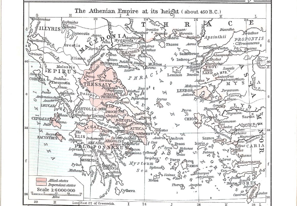
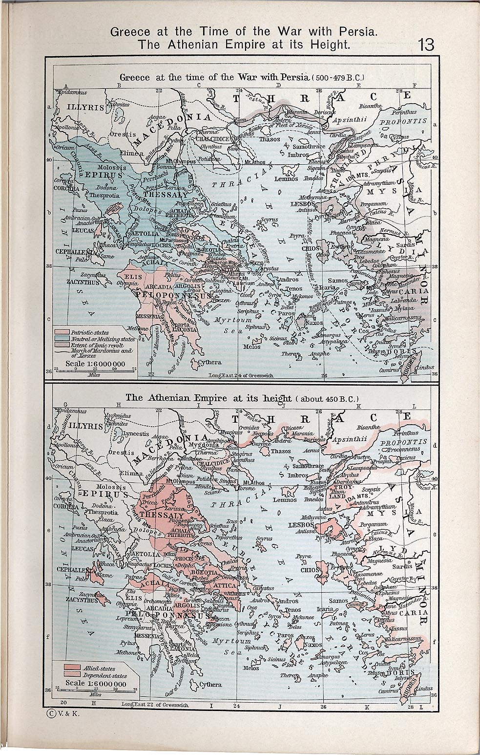
File:Athenian empire ps.jpg
Jump to navigation
Jump to search
Size of this preview: 800 × 555 pixels. Other resolution: 1,164 × 808 pixels.
Original file (1,164 × 808 pixels, file size: 299 KB, MIME type: image/jpeg)
Map of ancient Greece, height of Athenian Empire a decade before birth of Hippocrates.
From: http://www.lib.utexas.edu/maps/ and http://www.lib.utexas.edu/maps/historical/shepherd_1911/shepherd-c-013.jpg
The first site says: "Most of the maps scanned by the University of Texas Libraries and served from this web site are in the public domain. No permissions are needed to copy them. You may download them and use them as you wish. A few maps are copyrighted, and are clearly marked as such. Please Note: Maps on other
File history
Click on a date/time to view the file as it appeared at that time.
| Date/Time | Thumbnail | Dimensions | User | Comment | |
|---|---|---|---|---|---|
| current | 19:57, 11 March 2022 | | 1,164 × 808 (299 KB) | Maintenance script (talk | contribs) | == Summary == Importing file |
You cannot overwrite this file.
File usage
The following page uses this file: