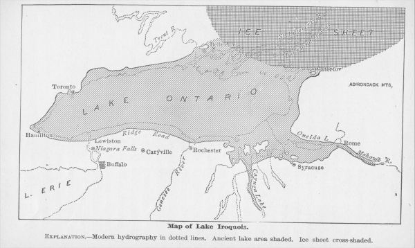
File:19th century estimate of the boundaries of Lake Iroquois.jpg
Jump to navigation
Jump to search
No higher resolution available.
19th_century_estimate_of_the_boundaries_of_Lake_Iroquois.jpg (600 × 358 pixels, file size: 133 KB, MIME type: image/jpeg)
This media, 19th century estimate of the boundaries of Lake Iroquois.jpg, is in the public domain
Any copyright on this work has expired.
This applies to in the European Union, the United States, Canada, and other countries with a copyright term of life of the author plus 70 years.
You may freely copy, distribute, display and perform this work, as well as make derivative and commercial works.
File history
Click on a date/time to view the file as it appeared at that time.
| Date/Time | Thumbnail | Dimensions | User | Comment | |
|---|---|---|---|---|---|
| current | 19:51, 11 March 2022 | | 600 × 358 (133 KB) | Maintenance script (talk | contribs) | == Summary == Importing file |
You cannot overwrite this file.
File usage
The following 3 pages use this file: